Wind, sun and towering clouds over Connemara, Galway Bay a choppy mass of white horses, and Inisheer the shape of a pale grey currach upturned in the sea, with bursts of white spray demarcating the shoreline as we butted out aboard the Doolin ferry. It’s always a shock to remember that the three iron-grey Aran Islands, with their cracked and flower-bespattered limestone, belong politically to granite-hearted Co. Galway, rather than Co. Clare of whose Burren region they are insular outcrops.
Safely landed, and walking the north-west shore of Inisheer along a massive storm beach of grey boulders piled ten feet high, we looked across to neighbouring Inishmaan, its white houses sunlit against slaty clouds under a technicolour rainbow. A gannet wheeled on long black-tipped wings before plunging down like a dive-bomber to smack into the sea on top of some unfortunate fish.
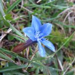
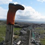
The back of Inisheer is divided into hundreds of tiny fields, each enclosed by walls of rough stone blades and boulders so intricately positioned that they look like artists’ installations – an effect enhanced by the chinks of white, grey, blue and silver sky caught like stained glass between the stones. In the fields we found watchful horned cattle, doleful piebald horses, and such a profusion of wild flowers it was hard to know where to look first – on this spring day, primroses, bluebells, milkwort, buttercups, cowslips, early purple (and white) orchids, and just-emerging flowers of bloody cranesbill of a deep, rich, episcopal pinky-purple. Pride of the place, though, were the spring gentians – royal blue trumpets raised skywards, of a colour so vivid and intense it always takes one by surprise, spring after spring.
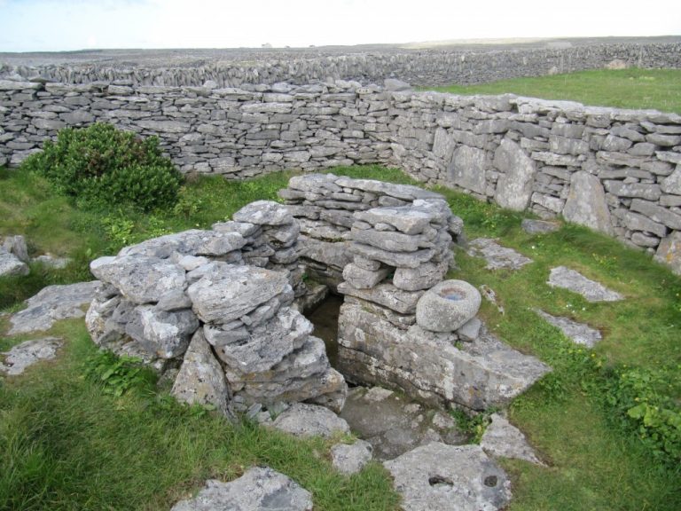
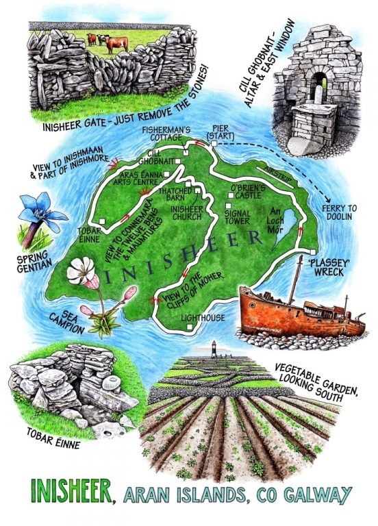
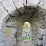
Tobar Éinne lay by the lane side, a beautifully kept holy well in a double curve of stone wall like a yin-yang symbol, the entrance marked by a weather-smoothed bullaun with a smidgeon of rainwater held in its hollow for a wish or blessing. The lane led us back to Cill Ghobnait on the outskirts of the village, a diminutive stone church, well over a thousand years old, with great thick walls and a tiny arched east window. Then we fumbled and wandered our way back to the south end of the island, with views widening over the waist-high stone walls, south-east to the abruptly stepped silhouette of the Cliffs of Moher, north to the crumpled blue backbone of the Maumturks and Twelve Bens against the smoking rain clouds over Connemara.
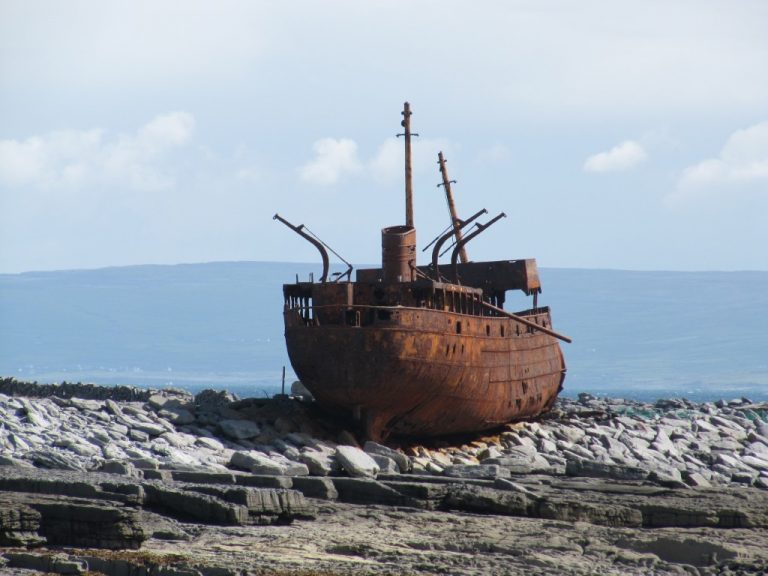
Nearer at hand, Inisheer’s lighthouse raised a black and white striped finger on the southern shore. White rollers were creaming in from an indigo sea to crash on the rim of the island. We followed the well-beaten path over the pebbles, accompanied by flights of oystercatchers with their plaintive p’cheep! of a call, towards the rusty old hulk of the freighter Plassey lying stranded for ever more on the storm beach of Inisheer’s most easterly point.
Plassey was thrown ashore during a storm in 1960 and she has lain here ever since, gradually acquiring a fiery orange coat of rust and losing chunks of herself to wind and weather. Jackdaws were strutting the bridge rails and funnel of the broken-backed hulk, and the rocks and boulders all around lay stained a rich ochre. We idled in her shadow, kicking up the pebbles, before hiking back over the hump of the island into the blast of the Galway Bay wind once more.
WAY TO GO
MAP: OS of Ireland 1:50,000 Discovery Sheet 51; ‘Folding Landscapes’ 2.2 inches/mile ‘Oileáin Árann’ map; downloadable map/instructions at discoverireland.ie/walking.
TRAVEL: Ferries from Doolin (Doolin Ferries 065-707-5555; 087-958-1465) or Rossaveal (091-568903; aranislandferries.com); flights from Connemara Regional Airport, Inverin (091-593034; aerarannislands.ie)
WALK DIRECTIONS: There are 2 National Looped Walks on Inisheer – ‘Lúb Ceathú an Phoillín’ (purple arrows) and ‘Lúb Ceathú an Locha’. Most of the island can be seen in a day’s wandering along the narrow, winding lanes and boreens. If you get lost, don’t worry – head north and you’ll end up in the village.
The walk as described: From pier turn right, then uphill to T-junction. Follow ‘Fisherman’s Cottage’ past café and on along coast road, which becomes stony. Where tarmac lane comes in on left, follow it past Tobar Éinne. At next corner, left (yellow arrow) back to village. Pass Arts Centre, then first right, first left, first right by thatched barn. Carry on, to turn right past church. At Y-junction, right. First left along lane. At Y-junction, right; in 50 m, right again and follow tarmac lane. In 300 m, left by Looped Walks arrow post along green lane to tarred road. Right to south shore. Left past lighthouse (red blobs) to wreck of Plassey. Follow road back to village.
LENGTH: 12.5 km/7 ½ miles – allow at least 4 hours
GRADE: Easy
CONDITIONS: Roads, green lanes and lots of wobbly pebbles – take ankle supporting footwear.
DON’T MISS:
• Wild flowers everywhere
• Tobar Éinne holy well
• Wreck of the ‘Plassey’.
REFRESHMENTS: Fisherman’s Cottage café (099-75073; 087-904-2777) – try their delicious breakfasts, also fish pie and lemon posset.
PICNIC SPOT: Anywhere sheltered – it depends which way the wind’s blowing!
ACCOMMODATION: South Aran House (contact as for Fisherman’s Cottage) – €76 dble B&B – comfortable, friendly and extremely helpful.
WALKING IN IRELAND: Walking tour operators, local walks including Discover Ireland’s National Loop Walks, walking festivals throughout Ireland: www.discoverireland.ie/walking and www.coillte.ie
BOOKS:
• Wildflowers of Ireland by Zoë Durlin (The Collins Press) – a marvellous, beautifully illustrated compendium
• Christopher’s book Walking in Ireland (Ebury Press) contains 50 of his favourite Irish Independent walks.
INFORMATION: 099-75008; inisoirr-island.com